Narrative
The maps Story

The Maps Title Block
I acquired this map in 2004 from a second hand bookshop in England. It is in two parts, one covering the north and the other the south of the Island of Mahé, which is the main island in the Seychelles. Placed Together the combined maps are quite sizable measuring approximately 950mm by 650mm. The island surveyor S.B. Hobbs created the maps for the Seychelles government on 27th September 1900. He based the map on information from the existing ordnance survey data and the information collated by the survey ship HMS Stork that had surveyed the islands 10 years earlier. The map also contains the land boundaries and details of all the significant landowners of the time.
HMS STORK
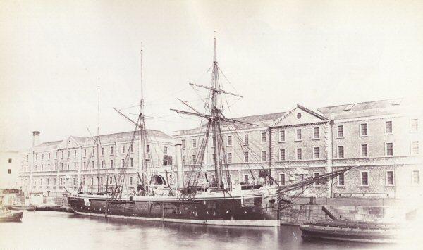
The survey ship that produced the island survey, of which this map was later based upon, was HMS Stork. She was a 4-gun composite screw gunboat, built at the Samuda Brothers engineering and ship building firm on the Isle of Dogs in London, and launched on 18th May 1882.
One of eleven banterer class gunboats built between 1880-1882 HMS Stork was 38m long and 7.16m wide displacing 465 tons standard, and typically had a crew of 60. The ships were of composite construction, meaning that the iron keel, frames, stem and sternposts were of iron, while the hull was planked with timber. This had the advantage of allowing the vessels to be coppered, thus keeping marine growth under control, a problem that caused iron-hulled ships to be frequently docked.
She was used as a survey ship from 1887, lent to the Navy League in 1913 and moored at Hammersmith as a training ship for boys, before finally being broken up at Rainham, Essex in 1950.
Banterer Class Gunboat
COMMANDER BALFOUR
The Commander Balfour RN referred to on the map is Andrew Francis Balfour born 28th May 1851. He served as a Lieutenant on the Challenger scientific expedition (1873-1875), and commanded the gunboat HMS Stork off east Africa (1889-1891) during which time the island survey of Mahé was conducted which formed the basis for this map. Later in his career he went on to Command HMS Penguin on a Pacific survey (1893-1896). From death records it appears he died 8th July 1906 at the age of 54.